News
09.07 2026
Yield map: from data collection to effective management decisions

Nowadays every hectare of land in agriculture has its own productivity potential. Even within a single field, yields can vary significantly depending on soil properties, topography, moisture levels, cultivation technology, and many other factors. Therefore, yield maps have become a key tool in precision farming, enabling farmers to move from one-size-fits-all solutions to differentiated field management.
24.06 2026
CRM for agribusiness: how to secure the land bank and build trust with shareholders
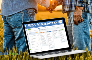
In modern agribusiness, equipment, elevators, or even yield are not the only competitive advantage. The most valuable capital of any agricultural enterprise is the shareholders, landowners, and the trust they have to the head of the enterprise. It is on the quality of interaction with landlords that the stability of the land bank, the possibility of its expansion, and the company's reputation in the region depend.
12.05 2026
Digital Agro Scouting: How to Turn Data into Yields and Profits
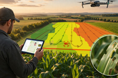
Modern agriculture is about managing risks in the face of climate instability, pest threats, and ever-increasing production costs. In such circumstances, digital agro scouting becomes not just a control tool, but an early warning and productivity management system. Download Android Download iOS What is digital agro-scouting and why is it useful for a farmer? Digital agro-scouting from Soft.Farm is a systematic monitoring of crop conditions using specially developed software, mobile applications, satellite images, vegetation indices, recording of local inspections and analytics in a single platform.
26.04 2026
Вздовж чи впоперек? Як напрямок гонів впливає на витрати ЗЗР і кількість суміші

Вздовж чи впоперек? Як напрямок гонів впливає на витрати ЗЗР і кількість суміші
16.02 2026
Seeing the invisible: How NDVI helps prevent crop loss

Modern agriculture is increasingly relying on data and digital technologies. One of the important tools for monitoring crop conditions is the Normalized Difference Vegetation Index (NDVI), which allows farmers to quickly and objectively assess crop growth and make informed management decisions. Every field has its own yield potential. The only question is whether you are using it 100 %. Thanks to NDVI, you can get a complete picture of the condition of crops without constant trips to the field — quickly, accurately and on time.