Please wait...

22.10 2020
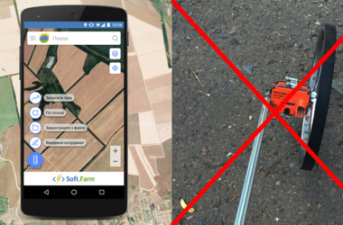
Field area measurement is based on the process of collecting raw land bank data. There are often cases when information from the cadastral map or the area prescribed in lease agreements is used for calculations. The reliability of these data does not raise any doubts, however, as a result, the agricultural enterprise receives a legal area, which in fact has little in common with the size of the actually cultivated land.
15.10 2020
Very soon, from 28 to 30 October, the international agro-industrial exhibition «InterAGRO 2020» will be held. It will be held at the International Exhibition Center in Kiev in compliance with all safety requirements for the prevention of coronavirus. The exhibition promises to be special, because it gives visitors the opportunity to see and evaluate the level of development of the agro-industrial complex of both Ukrainian and world producers.
07.10 2020
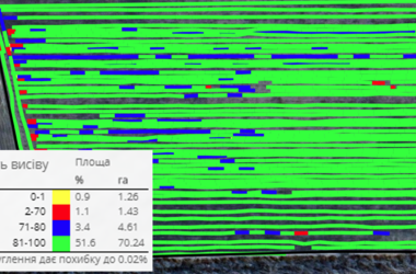
The autumn sowing campaign is the basis for the financial health of an agricultural enterprise for the next year. For effective management during this period, it is necessary to take into account a number of parameters that can significantly affect the final result. During sowing, the characteristics of the equipment involved, the quality of the seed used and the organization of the work process in general play an important role.
23.09 2020
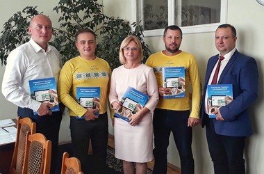
We are glad to inform you that Soft.Farm starts cooperation with the National University of Life and Environmental Sciences, which is the leading higher agricultural educational institution in Ukraine. The purpose of such cooperation lies in the development, improvement and popularization of the latest IT technologies among agricultural enterprises through the training of highly qualified personnel, since students, like no one else, can bring innovative ideas and knowledge that the agricultural industry needs so much.
10.09 2020
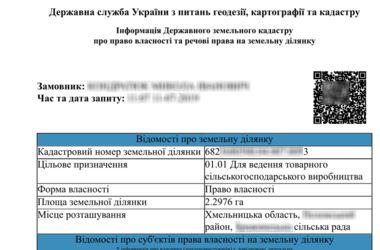
The beginning of land relations lies in the determination and assignment of cadastral numbers to plots during state registration. The cadastral number is a key component in obtaining and transferring rights to use land, changing its purpose, and is also directly involved in concluding lease agreements. Thanks to it, you can identify the plot and determine its location. For many years now, the electronic public cadastral map of Ukraine allows you to receive information on the boundaries, sizes, location, form of ownership and purpose of any cadastral plot online, and also provides information about the owner and user of the land.
Please wait...