How to measure the area of a field and create an electronic map of fields in shape, kml or plt format
22.10 2020

Field area measurement is based on the process of collecting raw land bank data. There are often cases when information from the cadastral map or the area prescribed in lease agreements is used for calculations. The reliability of these data does not raise any doubts, however, as a result, the agricultural enterprise receives a legal area, which in fact has little in common with the size of the actually cultivated land. The farm's fields are constantly changing: forest belts and shrubs grow on them, roads and ravines appear, waterlogs, soil erosion and other relief transformations form. This entails the need to keep field maps up to date, which will significantly reduce costs during land cultivation, sowing, watering, fertilizing, harvesting and other works.
When digitizing a land bank and compiling electronic maps, different methods of measuring the area of fields are used. The main ones are bypassing or detouring the field around its perimeter, using satellite data and flying around the field by drones. Each of the technologies has its own advantages and disadvantages and is targeted at different consumers.
During a drone flyby, a large number of images are taken, which are partially overlapped. It allows obtaining detailed orthophotomaps and taking into account losses within the field. This method is the most accurate area measurement tool, but quite costly.
Satellite-assisted field boundary detection achieves an accuracy of up to 2 % and can be used in areas where UAVs are prohibited from flying. However, the survey can be carried out only in cloudless weather and for the correct correlation of the obtained images with real coordinates on the ground, the help of surveyors will be needed.
Bypassing or detouring fields with a mobile device is inexpensive and affordable for independent use. If you measure an area using a GPS signal from a mobile device, the measurement error can be up to 3 %. For more accurate measurements, it is possible to connect external antennas to receive GNSS or RTK signals via Bluetooth, which dramatically improve the quality of field area measurements and provide positioning accuracy, the error in which is less than 1 %.
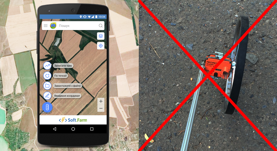
The easiest way to measure the area of a land plot is to use a mobile device with the installed Soft.Farm`s application «GPS. Fields. Area Measurement». With its help, you can create fields and measure their area in different ways, for example, circle a land plot on the map with your finger or mark points between which you need to measure the distance without leaving your office. To measure the area of the field on the ground, the track recording function is used, thanks to which you can follow the perimeter of the land plot, using a smartphone or tablet as a GPS receiver, and then save the track in KML format for further exporting the file. You can also import ready-made files in KML, PLT or SHP formats or enter the existing coordinates of control points manually.
In short, each agricultural enterprise chooses the best way to measure the area of fields based on its needs. However, different platforms give the final data in different formats, for which you often have to use third-party programs. Today, one of the most common formats is the Shape file, which has already become a standard for data exchange between geographic information systems. This vector format of geographic files allows storing various types of geometric objects, such as points, lines, polygons, polylines, etc. The Soft.Farm team has implemented the ability to upload ready-made files in Shape (shp) format to its mobile application «GPS. Fields. Area measurement», and now its use has become even more convenient.
An electronic map of fields is a necessary element for the implementation of precision farming, forecasting yields, budget optimization and settlement of territorial disputes with neighbors. Download the mobile application «GPS. Fields. Area Measurement» and digitize your fields with it absolutely free.
Back to news list