News
10.09 2020
How to use open data from SLC and SRRR to manage a land bank
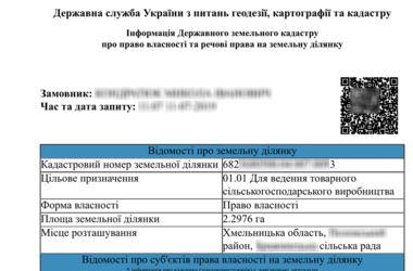
The beginning of land relations lies in the determination and assignment of cadastral numbers to plots during state registration. The cadastral number is a key component in obtaining and transferring rights to use land, changing its purpose, and is also directly involved in concluding lease agreements. Thanks to it, you can identify the plot and determine its location. For many years now, the electronic public cadastral map of Ukraine allows you to receive information on the boundaries, sizes, location, form of ownership and purpose of any cadastral plot online, and also provides information about the owner and user of the land.
20.08 2020
How to measure the area of a field with an accuracy of 0.2 m
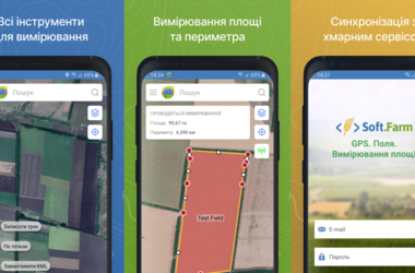
Modern systems for measuring fields allow making accurate measurements of the area of a field, calculating its perimeter, length and building a map based on these data. They save all the measurement results for further work and analysis, because, as experience shows, the actual area of the field does not always coincide with that indicated in the documents. Knowing the real size of the cultivated land is of tremendous importance for farmers, since inaccurate information can distort information on crop yields, complicate the maintenance of cadastral records, planning of field work, etc.
17.08 2020
Presentation of a new approach to counting cultivated hectares using GPS monitoring
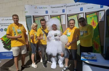
This year has made its own adjustments to the existing plans and added many difficulties on the way to their implementation. Nevertheless, the organizers of the 32nd international agro-industrial exhibition "AGRO-2020" made every effort to hold it under quarantine conditions at a decent level, and they succeeded. The exhibition was rich and interesting. It was held from 11 to 14 August, it was visited by Ukrainian farmers and guests from abroad.
30.07 2020
«AGRO-2020»: Presentation of a new concept «Calculation of the volume of work performed (hectares)" based on GPS-monitoring of agricultural machinery
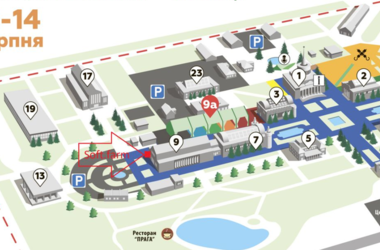
«AGRO-2020» will take place! This international agro-industrial exhibition will traditionally be held at VDNG and will once again contribute to the implementation of innovative projects in all areas of the agricultural sector. The Soft.Farm team's stand will be very easy to find, because from 11 to 14 August it will be located at the entrance to Pavilion 9. We will be glad to every visitor, as we present a new function of our web service and want to share it.
16.07 2020
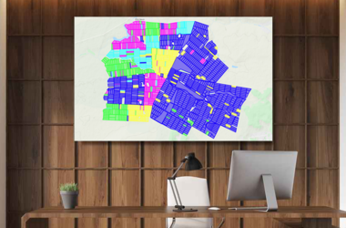
Cadastral map as a land bank management tool
The efficiency of the land bank management system, which is a key production asset, largely depends on the work of the land department, namely on the quality of the lease agreements and their further accounting in software systems. Today, the Soft.Farm web service has all the necessary tools for cadastral accounting, which includes visualization of farm fields and all cadastral plots located on the territory of the cultivated areas and beyond, a system of operational reporting in the context of fields, branches, village councils, tenants, as well as structuring of all lease agreements, indicated on the map with certain colors and markers in accordance with their type, status, validity period, distribution, etc.