Land audit as part of a comprehensive territorial development plan
07.04 2021
The main goal of the decentralization reform is to transfer a significant part of powers, resources and responsibility from the executive authorities to local self-government bodies. The concept is to unite villages into large communities in order to transfer broad financial and managerial autonomy to such entities. On June 12, 2020, the Cabinet of Ministers of Ukraine adopted a decree on the definition of administrative centers and the approval of the territories of the communities of the regions. As a result, territorial communities have been created in the country, which are an effective, understandable and convenient management system for residents.
However, newly created communities will not automatically become wealthy. Yes, more powers and money have appeared there, but this does not mean development, since the funds and resources received must be used effectively. Also, large tracts of agricultural land have been transferred to communal ownership of territorial communities and the further filling of the budget and planning for sustainable development depends on how well the audit of the land bank is carried out.
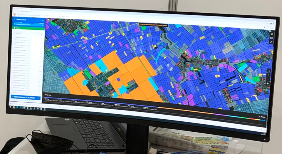
One of the problems that land surveyors face during the inventory of lands is the fragmentation of programs and the lack of prompt access to the necessary information. The community's land map, at best, they open on a specialized website, although often it hangs on the wall in paper form, the list of cadastral plots and all the necessary data on them are stored in an Excel file, the Public Cadastral Map of Ukraine and the State Land Cadastre page are open in browser windows and in the end there is no final decision on how to bring all the data together.
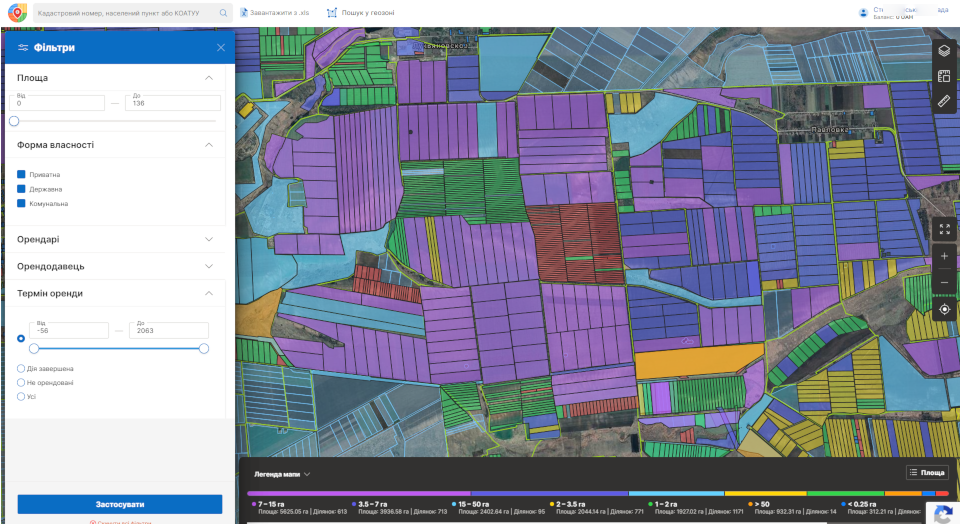
Agricultural enterprises have long since started to digitize their farms, although not everyone knows that united territorial communities (UTC) can also switch to digital. To do this, first of all, you need to create an electronic map of the land bank of the community with the designation of cadastral plots tied to village councils and located outside the settlements. Previously, the sites outside the settlements were managed by the State Geocadastre, but not all of them were inventoried and accounted for. As a result, further work on their systematization is completely transferred to the communities, and in this case, much depends on the amount of initial data. To assess the fullness of the land bank, the Cadastre UA service can obtain information on the geofence by searching for cadastral plots within the territorial boundaries of the UTC, find the necessary data using the COATOU code, or download the existing information from Excel files.

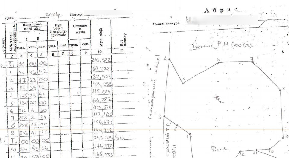
With the help of the electronic map of the land bank of the community, it is easy to identify inaccuracies and errors in cadastral registration on the lands received at the disposal. And if the errors in the geometry of the contours of the plots can be corrected by contacting the cadastral registrar through various communication channels, then it becomes more difficult to resolve the issue of lands that are absent on the PCMU, and therefore in the national cadastral system. Most often this happens due to the fact that land owners have state acts on the ownership of the old model, which makes it impossible to display information in automatic mode. In this case, changes to the SLC are made on the basis of the developed technical documentation for land management regarding the establishment of the boundaries of land plots in kind, land inventory materials, documentation for land valuation or by court decision. Often, interested tenants who want to legalize squatting or unjustified use of land take over the payment for the development of technical documentation. But this also has its own benefit for territorial communities, since after the transfer of land from shady cultivation to legal use, they will receive rent and tax revenues.

Digitization of the UTC land bank with the help of Cadastre UA is not only an electronic map of the community with the contours of cadastral plots and data visualization with the PCMU. This is systematized information in digital form, which is stored in one service. In addition to attributive data for any cadastral site, we provide access to information from state registers. The register of the State Land Cadastre helps to strengthen control over the use and turnover of land, and the State Register of Real Rights to Real Estate, in accordance with the Law of Ukraine, is a unified state information system that ensures the processing, storage and provision of information about registered real rights to real estate and their encumbrances, as well as about the objects and subjects of these rights. The SRRR contains data not only on tenants and landlords, but also on the expiration dates of the concluded lease agreements, as well as their types. Such information will be important for the heads of territorial communities for many reasons. Information on registered ownership and use rights will help to avoid conflict situations when landlords apply for non-receipt of rent or processing of their land under expired lease agreements. Timely contact with the landowner about the extension of the contract will contribute to the receipt of administrative fees for the registration of property rights, and subsequently tax deductions to the local budget. Communication with land users on the basis of verified data will give certain levers of influence on them and will involve them in the inventory of cultivated lands. This will make it possible to sell lease rights at land auctions, and tenants will come out of the shadows into the plane of legal land use.
In both cases, a high-quality audit of the land bank of the territorial community will lead to filling the local budget and will allow you to see both problems and potential opportunities for further development. The information in the system can be supplemented and updated, and a pleasant bonus in the work will be the ability to integrate and exchange data between the agricultural enterprise and the UTC. Services Cadastre UA and Soft.Farm provide good synergy for completeness and correctness of cadastral registration, and also allow effective planning of the existing land resource base.
Back to news list