The mobile agronomist is a new level of analysis and forecasting of yield
07.05 2024

In recent years, the level of implementation of innovative technologies in the agricultural sector has increased significantly. Progressive specialists are increasingly expanding their capabilities, using specialized applications and advanced IT solutions in their activities to obtain complex and timely information about the condition of soils and plants. In particular, such functions are performed by the field monitoring process, which can be used to determine the level of germination of crops, the degree of their contamination by diseases or weeds. It makes it possible to make management decisions about soil treatment, the need for fertilizers and pest control.

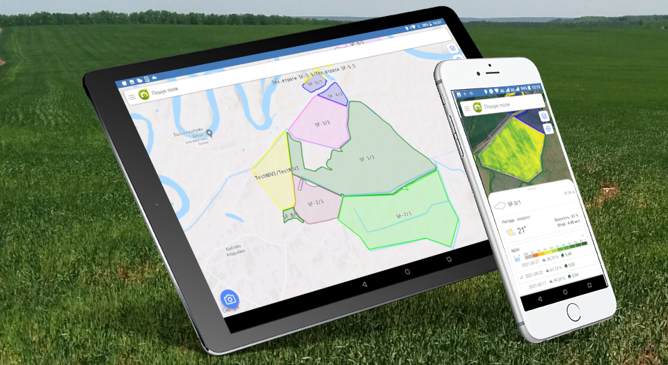
Agroscouting, or «Crop scouting» is used to automate the process of collecting information directly in the field according to established parameters by using remote control programs. It monitors the condition of crops, quality control of the work performed, and also helps to check compliance with crop cultivation technologies and the phytosanitary condition of the fields. The «Agroscouting» module from Soft.Farm is a program with access to the Cloud Service cloud database and provides the following capabilities. The advantage of saving information on such a platform is the ability to access your own data from any device anywhere in the world. It is also a guarantee of information security and protection. The mobile application «Agroscouting» allows you to increase the speed of work and improve its quality. Built-in satellite navigation makes it easy for farmers to find fields for inspection by drawing up the appropriate Act, adding photos and notes, and the program will automatically record the dates and times of such visits.
Agroscouting is important when there is more than one agronomist working at the enterprise. The system is necessary for synchronizing all the data entered by the scouts according to a single structure, building a communication channel between the participants of the production process and their effective interaction. Collecting data in the field using a tablet with the mobile application «Agroscouting» is more convenient than making unstructured notes in a notebook and storing photos on a separate gadget that can be lost. The complete database of plant diseases, identified pests or weeds, loaded into the application, helps to find a solution faster. In addition, «Agroscouting» allows you to set up the effective work of everyone even remotely, because with its help you can assign a new field inspection task from a computer to a mobile device.
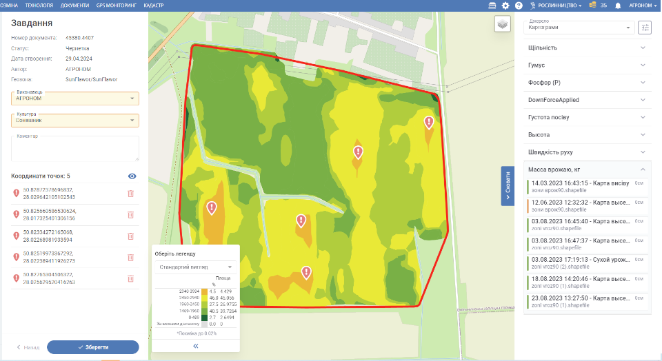
The functionality of the mobile application includes satellite images that allow you to see the current NDVI index in the field and identify problem areas. Their high resolution allows for highly detailed images. Satellite images or any monitoring images of the field give an idea of which areas in the field are more fertile and which are less productive and problematic. Ultimately, such a regular audit makes it possible to reduce production errors that annually lead to inefficient investment of resources, incorrect application of chemicals and, as a result, to further crop losses.
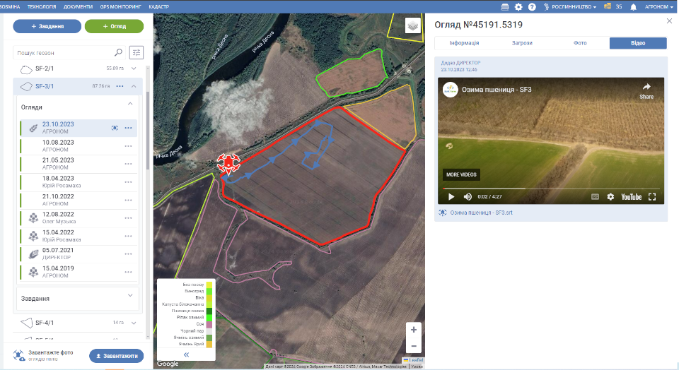
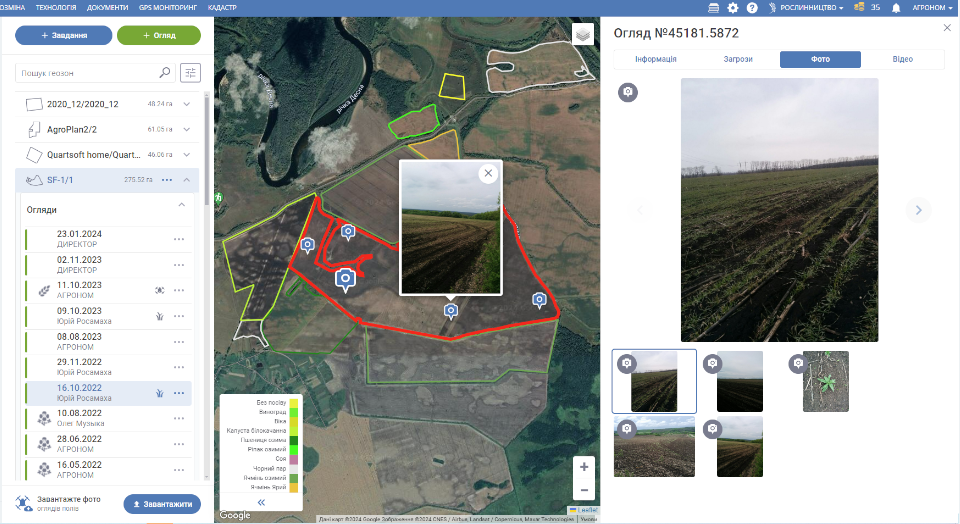
Nowadays, monitoring of fields with the use of drones, which explore a specific area and take photos or videos there, is spreading. In the web version of the «Agroscouting» module, you can add «.SRT» format files. You can see on the map where the drone is and see its track.
It is also possible to batch download all the pictures taken during field survey. The user adds pictures to the system, and the program itself determines the location of the picture, creates an overview, attaches it to the field under study and places a marker on the map.
Field monitoring plays an important role in planning the activities of enterprises, provides opportunities for developing strategies and timely decision-making regarding the need to carry out work in the fields. Agroscouting makes it possible to strengthen the supervision of the state of the fields by creating an archive of data on each plot, which can be used when planning the next technological operations. In the «Agroscouting» mobile application, you can see not only satellite images with the current NDVI index on the field, but also an archive of satellite images for any period of time. Current weather data, a satellite image with its date, cloud cover at the time of shooting, and indicators of the vegetation index are recorded for each field. Collected data can be quickly retrieved and used to conduct research and build analytical reports.
Therefore, agricultural scouting solves such problems as identifying deviations in the work of the enterprise even after the completion of seasonal work and improving the results of areas with lower indicators. Only a complex combination of human resources with innovative technologies is the guarantee of obtaining the best results from increasing the production efficiency of enterprises and their competitiveness.
Back to news list