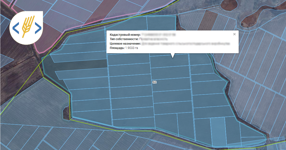
Soft.Farm + cadastral map of Ukraine
18.08 2016

In 2013, Ukraine made a significant step towards the creation of a national structure of geospatial data - Develop a public cadastral map, which is freely available. Information technology is evolving and improving, so we walk in step with the times. The development team Soft.Farm system has taken into account the needs of our customers, you can now receive data from the electronic cadastral maps, to analyze to take appropriate decisions as soon as authorization Soft.Farm system. Electronic land registry contains information about the land allotments, their purpose assigned cadastral number and area, coupled with the possibilities offered Soft.Farm service creates a reliable tool for efficient use and control of state land sites. It is important to note that you can now apply the border management field and as a field of view is divided in the inventory, in fact, the new features made it possible to put the field on the cadastral map was the definition of innovation, if earlier, such technologies have not been opened to the public domain in Ukraine. Do not hesitate, organize your work and self-monitor the relevance of your land the accuracy and reliability of data. Predict the day ahead with Soft.Farm system http://www.soft.farm/uk/about
Back to news list