One-click cadastral contours
06.01 2020
For the effective management of a land bank, which has more than one thousand hectares, it is necessary to inculcate innovations. It needs to start with a quality audit of land plots and lease agreements, and the system chosen for implementation should ensure maximum automation of managerial accounting agricultural processes.
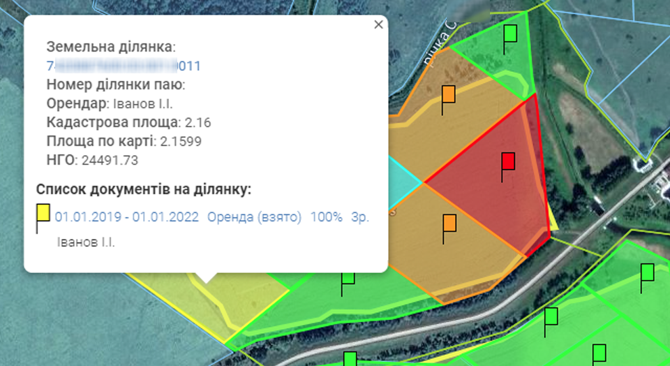
But how to understand how well a land bank is used? It is necessary to study all the risks and be sure that those land plots are processed that are rented. Using a public cadastral map of Ukraine, Soft.Farm created a simple way to check the location of leased land plots and the coincidence of unit boundaries with electronic maps of the fields of your agricultural enterprise. Visualization of the location allows you to see the entire map of plots and fields and to find discrepancies between the actually cultivated areas and the paperwork.
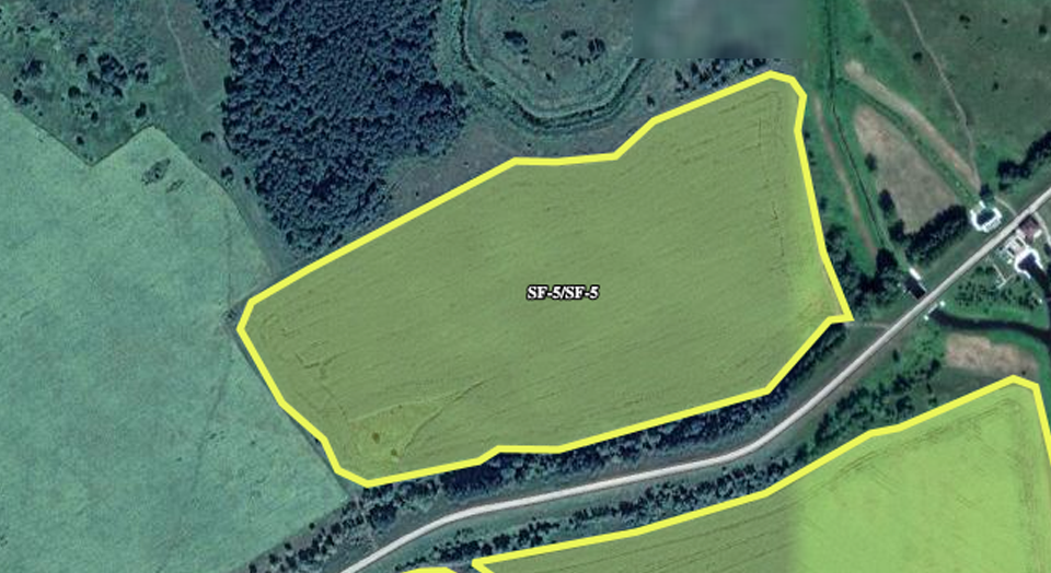
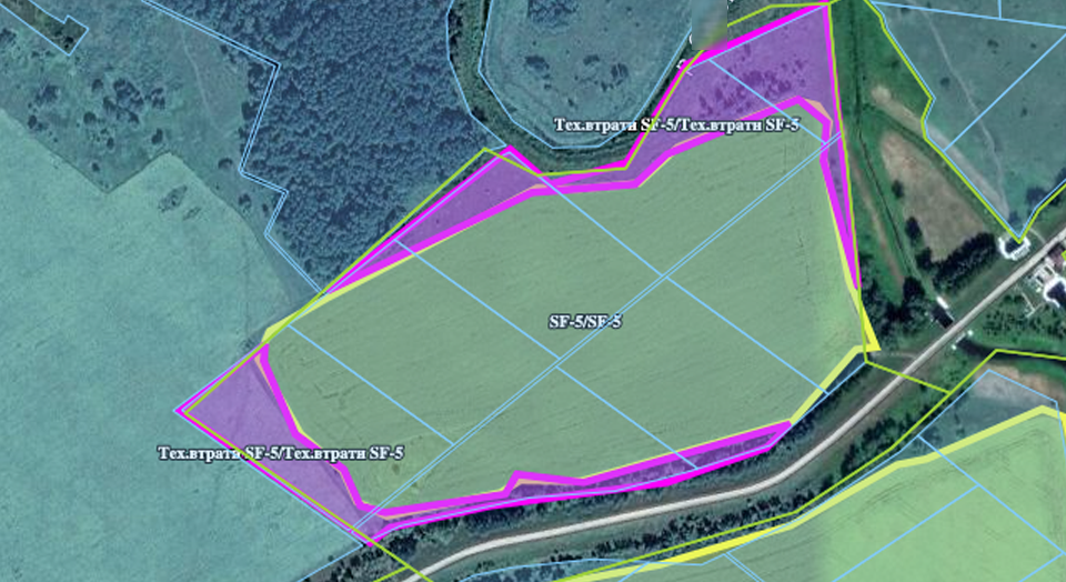
To make a quality audit of a land bank, which includes an analysis of technical losses, unused areas and neighbors' fields in the fields, clearly defined contours of cadastral plots are needed. They will help to identify units that are only partially located within the field, and since the lease agreement is concluded for the entire plot, it turns out that the company pays an extra rent. From this it follows that there is every legal reason to introduce these parts of the units into the cultivated area. You can also see the location of competitor plots and identify lands that are outside the fields, which entails additional costs. Therefore, it is necessary to plan and implement the exchange by visualizing this process on the map.
In order to easily see all the information on an agricultural enterprise, you need to have a list of cadastral plots. If you enter them manually and independently draw around the boundaries of the units, you will have to spend a lot of time on this, and besides, the accuracy of the manually circled circuits will not be too high. What to do in this situation? You just need to circle the boundaries of the cultivated area and Soft.Farm will do everything for you in a matter of minutes, even if the number of shares exceeds tens of thousands! In the system’s functionality, a vectorization module for cadastral plots is implemented. The accuracy of the vectorized contours reaches 20 cm, so the value obtained on the map of the cadastral area will be as close as possible to that indicated in the documentation. All information can be exported to KML files for further use and analysis, or for integration into other software.

The Soft.Farm web service will help tidy up the registration of lease agreements to reduce the risks of losing a land bank and will save resources that are used for other purposes. The preservation of the land bank of an agricultural enterprise is a directed, systematic work, which provides for the constant audit and control of lease agreements, actually cultivated areas and free land. It is very difficult to do without specialized software, so implement a management accounting system and create a single information space with us.
Back to news list