How to create an electronic field map
21.03 2020
For effective management of an agricultural enterprise, you need to know the structure of your fields and their exact area. Very often, old paper maps or data from cadastral plans are used for work, which have not been updated for a long time and do not always correspond to reality. Inaccurate information on the size of cultivated land can distort information about crop yields, complicate cadastral registration, field work planning, etc., in a word, lead to unnecessary costs for «nonexistent hectares» and entail problems when using precision farming tools.
Field area measurement is not a one-time procedure, since changes in the land bank occur, waterlogging, ravines, soil erosion form, forest belts and shrubs grow, roads appear and other terrain transformations arise, followed by the need to keep farm maps up to date. When compiling electronic maps, different methods for measuring the area of fields are used. The main ones include bypassing or detouring the field along its perimeter, using satellite data and flying around the field with drones.
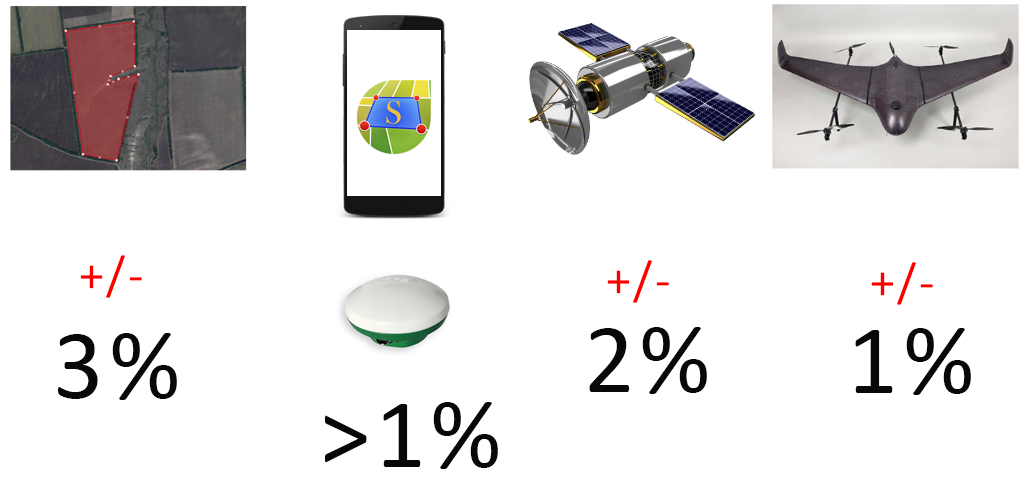
Each of the technologies has its own advantages and disadvantages and is aimed at different consumers. Overflight with drones is the most accurate tool for measuring field area, but quite expensive. Establishing boundaries using a satellite allows you to achieve accuracy of up to 2 %, but shooting can only be done in cloudless weather, and for the correct correlation of the obtained images with the real coordinates on the ground, you will need the help of surveyors. Detourin or bypassing fields using a mobile device is not expensive and is available for independent use. You can measure the area with a mobile application or a GPS receiver, but be sure to take into account that the error in this measurement can be up to 3 %, since the GPS signal is not stable and has a lot of «noise», which forms multidirectional points on the track with deviations of up to 4 meters. For small farms this will not be a problem, since the manager knows his fields no worse than the agronomist, but for large enterprises with thousands of cultivated hectares, a large error will significantly affect the formation of budgets and the allocation of resources between plots.

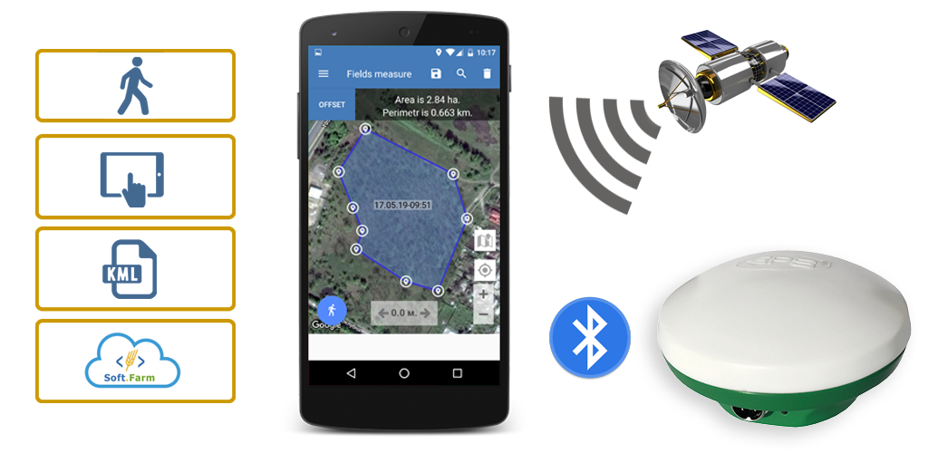
Soft.Farm team has improved its mobile application «GPS. Fields. Area measure» and now, in addition to the standard area measurement using GPS, a module has been improved that allows you to connect external antennas for receiving GNSS signals. Modern GNSS antennas are a separate product class that is designed to receive and pre-process satellite navigation signals and provides a guarantee of long-term reliable operation and high performance. Our partner in the production of GNSS antennas is the company «E.P.S.» It is a professional in the field of high-precision positioning and surveying. The use of GNSS-class equipment dramatically improves the quality of field area measurements and ensures positioning accuracy with an error of less than 1 %!
Thanks to the qualitative measurement of the area of your land, it is much easier to optimize the budget, obtain basic data for precision farming systems, satellite and GPS monitoring, as well as minimize technical losses during the inventory of the land bank.
Back to news list