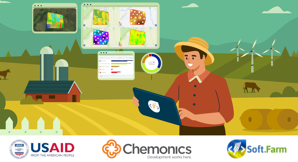
Electronic book of field history — the basis for the development of modern agronomy
15.03 2023
Each farm that is engaged in crop production has a field history book, compiled in paper or electronic form. As a rule, it reflects the technology of cultivation of crops and the history of crop rotations. It contains information not only about the areas of fields and the crop rotation schemes introduced on them, but also can store data on the physical and chemical properties of the soil, reports on the weediness of fields and their population with pests or diseases, record field work done, seasonal changes in vegetation indices, weather conditions and much more information. In a word, by analyzing the data accumulated in the book, it becomes possible to identify unproductive zones, plan measures to eliminate the problems found, and find reserves to improve the efficiency of fields.
Using the accumulated knowledge and experience, modern farms are trying to increase the return on their land. They experiment with fertilizers, crops, electronics and strive for maximum efficiency, which is to get the most profit at the lowest cost. In turn, the effectiveness in any activity is based on the possession of information, planning and feedback, but the array of available data is so large that it is difficult to identify patterns in it without resorting to the use of automated information systems.
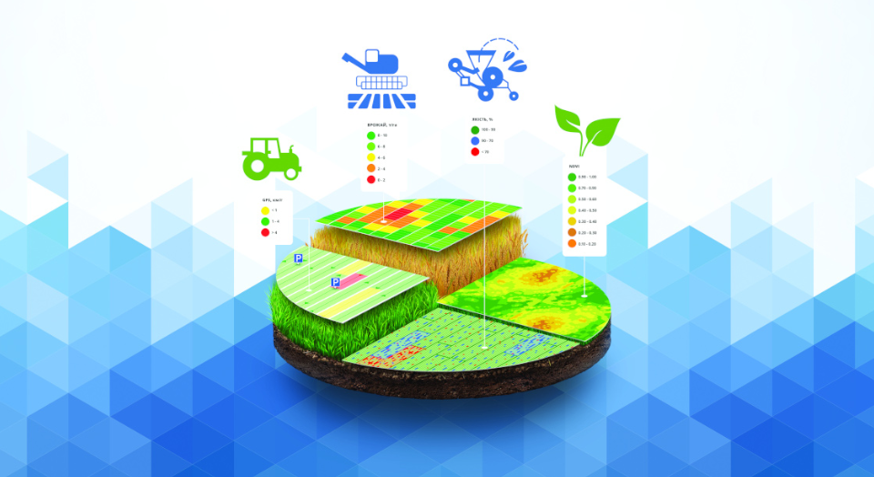
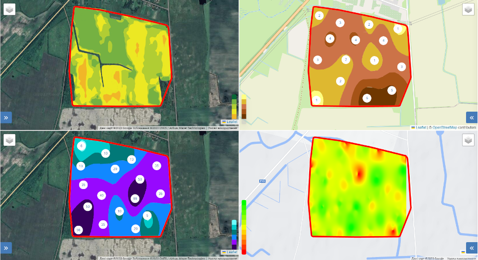
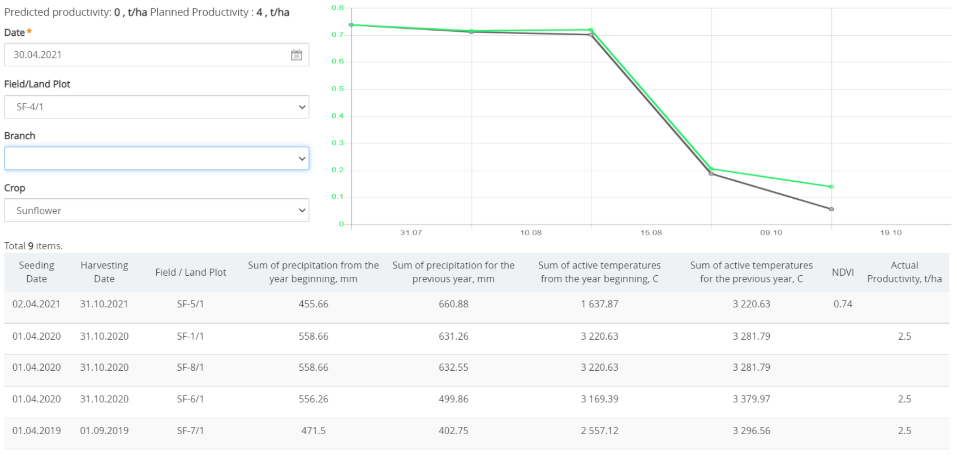
The field history book in the Soft.Farm web service allows you to store and analyze the information received. It is a database associated with an electronic map of the fields of the agricultural enterprise. The farmer can get the history of NDVI images, height maps and seeding quality maps, make several analyzes of the chemical composition of the soil for the year, analyze the density and moisture of the soil, accumulating the history of the processing of specific fields, analytical information on the state of their soils and on the yield of different crops. And this is only a part of what modern precision farming technologies provide. To process the available data, you can use one of the field history e-book tools in the Soft.Farm web service, namely the «Field Analytics» module. It is used to analyze the state of field parameters in dynamics (for example, indicators of soil moisture, its density or content of elements), to identify patterns (for example, multifactorial dependences of the yield of specific crops on soil parameters in the field), to predict the behavior of a particular crop in a particular field, and for other purposes.
Field analytics is a versatile tool that works with various sources of information. These can be both ordinary satellite images and data on the execution of technological operations transmitted by equipment while working in the field, files with the results of chemical analysis and the results of aerial photography by drones. Using a customizable interface, you can select the options for visually displaying information on several fields at the same time. Such a function is useful for detailed comparison of specific indicators or events at one point on any cartograms and maps. It makes it possible to compare both different indicators at one point in time, and one indicator over time.

To identify the causes of anomalies, it is possible to analyze the removal of elements across the field zones by different crops. By comparing the data, you can understand the dependence of yield on the height map or analyze the maximum yield crop for the current year, based on the maps of previous years and current weather conditions. In a word, any farm has the opportunity to conduct an analysis based on its needs. Currently, the «Field Analytics» module can work with any cartograms (for chemical analysis, density analysis, crop and fertilizer maps, yield maps, and many others), with any satellite images, with the results of agroscouting and with maps of technological operations. You can combine them as you like and compare even what seems incomparable.

The Soft.Farm web service provides the possibility of automated preparation of various information for analysis and calculations. Experiment, look at various dependencies, look for the weak and strong points of your fields, be efficient and earn the maximum on your land. The introduction of this kind of information systems gives a qualitatively new level of economic efficiency due to a more rational distribution of funds and allows you to use the potential of each site by 100 %.
Back to news list