Cadastral map on iPhone for land bank management
28.05 2020
The Soft.Farm team continues to develop the cadastral service and now, by popular demand, the «Kadastr UA» mobile application can be used not only on Android devices, but also on iOS!
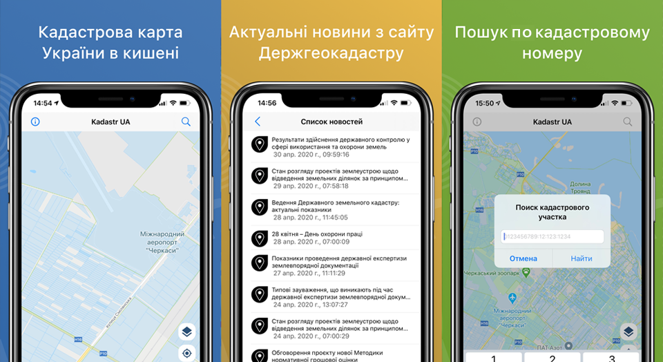
The new mobile application is compatible with iPhone, iPad and iPod touch and is supported starting from iOS version 12.0 and higher. The functional provides access to data from the Public Cadastral Map of Ukraine and with its help allows you to determine the location and boundaries of land on the map. In the menu section for working with the area, it is possible to independently measure the actual area of the plots and form their base by creating a land bank in kml format. You can record tracks by going around or bypassing cadastral plots using a mobile application, as well as simply outline the boundaries of units on the map manually, which allows you to compare the field boundaries of your agricultural enterprise with leased plots and conduct a qualitative analysis of land use. We also added the ability to receive GPS coordinates of land plots, for which you need to zoom the map and click on the desired point so that a message appears with data on the selected location, and when you click on any cadastral plot, information from the State Geocadastre is opened.

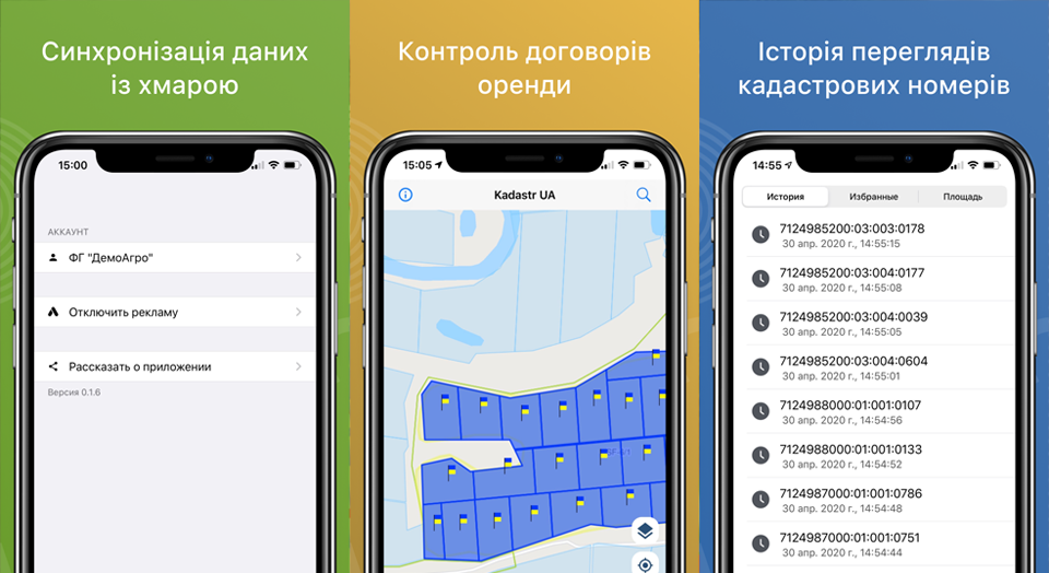
Unlike the map.land.gov.ua service, the mobile application saves the browsing history and allows you to enter the desired units into the list of «favorites», so you do not need to search or typing the cadastral number again each time — the «Kadastr UA» functionality provides access to these sites even in offline mode, and also makes it possible to send cadastral numbers using instant messengers. To keep you up to date with the latest changes regarding the activities of the cadastral service, Soft.Farm added the ability to read the news of the State Geocadastre directly from the mobile application. But this is not all: at any time you can synchronize data from «Kadastr UA» with the Soft.Farm web resource and use it in further work.
The mobile application «Kadastr UA» will be useful to surveyors, notaries, lawyers, farmers, as well as any other users who want to buy, sell or rent land. With its help, it is easy to determine the boundaries of the plots, their location and receive information about their owners or tenants from the State Geocadastre. You can download the «Kadastr UA» application absolutely free of charge in the AppStore or via the link .
Back to news list