Qualitative field survey using the vegetation index NDVI
15.07 2021
Agroscouting is the process of collecting information directly in the field in accordance with the specified parameters. It serves to monitor the state of crops and allows you to record not only the stages of plant development on the BBCH scale, soil condition, the presence of diseases, foci of weeds or pests, but also to monitor the quality of work performed on the field, as well as to form recommendations for its further processing.

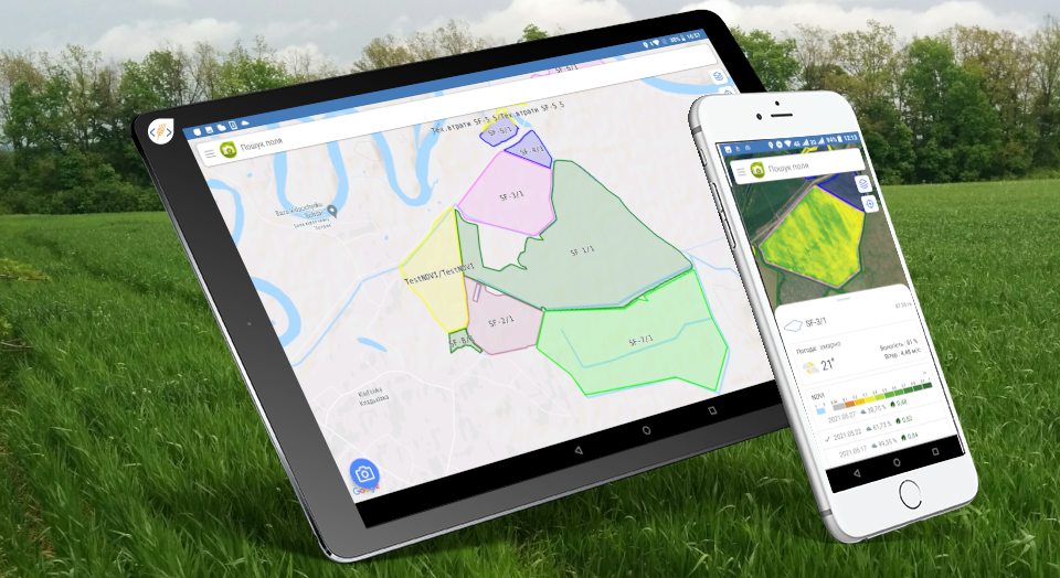
Collecting data in the field using the «Agroscouting» mobile application is much more convenient than creating numerous notes in a notebook and taking a series of photos, which in the end will be difficult to structure. The mobile application, thanks to the built-in satellite navigation, quickly finds fields and automatically registers the dates and times of their visits. Survey reports are also created with georeferencing to the surveyed areas, which makes it possible to control the quality of the survey. The agroscout adds photos and text notes using the complete database of diseases, identified pests or weeds uploaded to the app. In addition, problem areas can be identified using satellite images, which allows you to see the current NDVI in the field and make a more thorough phytosanitary assessment.
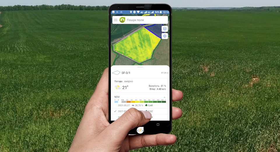
Our team has expanded the functionality of the «Agroscouting» mobile application and now you can see in it not only satellite images with the current NDVI index on the field, but also an archive of satellite images for any period of time. For greater clarity, the outlines of the farm fields are painted in the color of the crop being grown. All you have to do is click on a field to get actual weather data for it, a satellite image showing its date, cloudiness during shooting, and the value of the vegetation index itself.

Depending on the factors and conditions of soil fertility, meteorological conditions and crop cultivation technology, the rate of biomass development is different. In fields with a low NDVI, poor crop development is possible, and if the NDVI is high, then this can mean overgrowing with weeds, therefore such fields require special attention of the agroscouts. If problem areas are detected, identified using satellite images, the chief agronomist has the opportunity to give a new task to survey the field from a computer to a mobile application.
If spectral images show problems from year to year in the same area of the field, it will be easier for an agronomist to identify various factors that hinder the development of plants and eliminate or reduce their influence. As a result, you can get a full spectrum analysis and identify areas that need replanting, application of plant protection products or fertilizers. Analysis of images before entering the field saves time and helps to find hidden problems, and the mobile application makes it possible to structure information about the state of the fields and quickly share it with colleagues. You can create Survey Reports and add new photos even offline, and after synchronizing the survey data, a mobile device, when connected to the Internet, automatically uploads photos and GPS coordinates to the Soft.Farm web service, where they immediately become available to other users and are stored in field history.
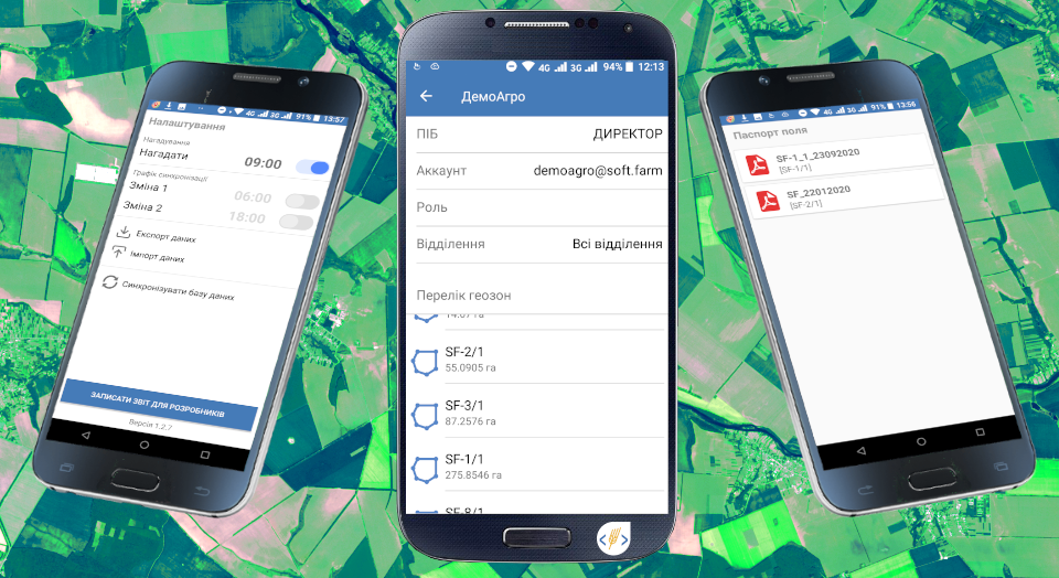
Modern scouting software provides access to a cloud database, and Soft.Farm «Agroscouting» is no exception. The peculiarity of the Cloud Service is that when you create an account on such a platform, you can access your own information from any device anywhere in the world. Using cloud services is not only convenient, but also safe, since data will not disappear even if something happens to your smartphone or computer. For greater user convenience, we have improved the mobile application and added a page containing user data, farm branches and associated fields, which can now be found on the map by clicking in the list.
Agroscouting helps to strengthen control over the state of the fields of an agricultural enterprise by accumulating an archive of data on each cultivated area. Such an accumulated array of information makes it possible to speak not only about stable control of the harvest, but also about the prospects for its increase.
Back to news list