How to measure the area of a field with an accuracy of 0.2 m
20.08 2020
Modern systems for measuring fields allow making accurate measurements of the area of a field, calculating its perimeter, length and building a map based on these data. They save all the measurement results for further work and analysis, because, as experience shows, the actual area of the field does not always coincide with that indicated in the documents. Knowing the real size of the cultivated land is of tremendous importance for farmers, since inaccurate information can distort information on crop yields, complicate the maintenance of cadastral records, planning of field work, etc., in a word, lead to unnecessary costs for «non-existent hectares» and entail problems when using precision farming tools.

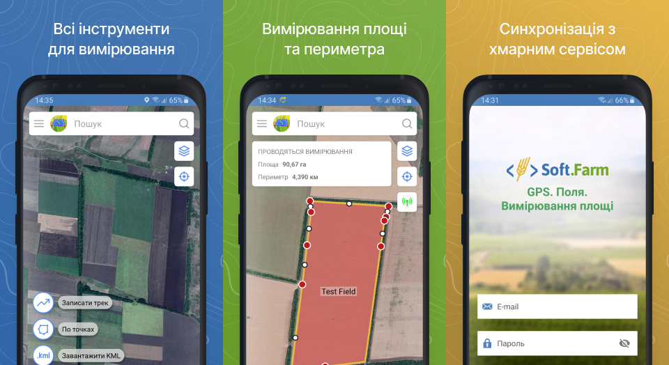
The easiest way to measure the area of a land plot is to use a mobile device with the installed Soft.Farm’s application «GPS. Fields. Area Measure». With it, you can create fields and measure their area in different ways, for example, circle a land plot on the map with your finger or mark points between which you need to measure the distance without leaving your office. You can also upload a finished KML file or manually enter the available control point coordinates. To measure the area of a field on the ground, the track recording function is used, with which you can follow the perimeter of the land plot, using a smartphone or tablet as a GPS receiver, and then save the track in KML format for further file export. However, it is imperative to take into account that the error in such a measurement can be up to 3%, since the GPS signal is not stabilized and has a lot of «noise», which forms multidirectional points on the track with deviations of up to several meters.

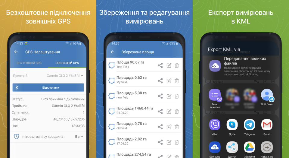
For accurate measurements, the Soft.Farm team added the ability to connect external antennas to receive GNSS or RTK signals via Bluetooth. Modern GNSS antennas represent a separate class of products for receiving and pre-processing satellite navigation signals and providing a guarantee of long-term reliable operation and high performance. The use of GNSS class equipment dramatically improves the quality of field area measurements and provides positioning accuracy, the error in which is less than 1%. It should be noted that navigation-type devices are not cheap and therefore cannot always be used. But external devices for household use, such as the Garmin GLO 2 antenna, which can now also be connected during measurements using the «GPS. Fields. Area Measure», are a good value for money and allow solving a large list of tasks. The Garmin GLO 2 is a small external GPS / GLONASS receiver with 10 updates per second. It is designed to connect to tablets, laptops or smartphones via Bluetooth. Garmin suggests using this receiver both with devices without a built-in GPS-module, and with smartphones, the native receiver of which does not have sufficient accuracy and sensitivity.
In addition to adding new features when using the mobile application, the Soft.Farm team has updated its design. Convenient and understandable functionality of the field area measurement system allows you to measure the desired area with a few clicks and get all the necessary data on the route traveled. In a word, when choosing a system for measuring the area of fields, first of all, you need to focus on its measuring accuracy, since the correct measurement is the most important step to improve the efficiency of agriculture and reduce costs at the enterprise.
Download the mobile application «GPS. Fields. Area Measure» and evaluate its benefits absolutely free on Google Play or by following the link.
Back to news list