Please wait...

21.03 2020
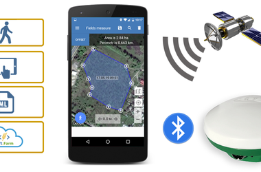
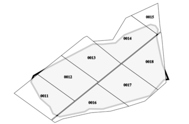
For effective management of an agricultural enterprise, you need to know the structure of your fields and their exact area. Very often, old paper maps or data from cadastral plans are used for work, which have not been updated for a long time and do not always correspond to reality. Inaccurate information on the size of cultivated land can distort information about crop yields, complicate cadastral registration, field work planning, etc.
02.03 2020
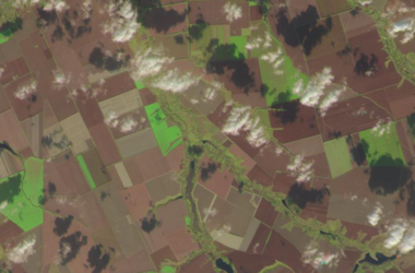
For operational monitoring of the state of crops, the technology for monitoring changes in the vegetation index, which was obtained by analyzing satellite images, has long been used.The spectral reflectivity of vegetation is characterized by large differences in the reflection of radiation of different wavelengths; therefore, knowledge of the relationship between the structure and state of vegetation and its spectral reflectivity allows the use of satellite images to map and identify types of vegetation and their states.
06.02 2020
From February 18 to February 20 at the International Exhibition Center (Kyiv) one of the main exhibition events of the agricultural sector of Ukraine — «AgroSpring 2020» will take place. The Soft.Farm team will present its stand № 3А09 (Pav.№ 3, entrance 3A) within the framework of the international exhibition of innovative solutions «Grain Tech Expo 2020». We will talk about the development of new functions of the software package and the improvement of already known modules, such as cadastral registration of land plots, GPS monitoring of equipment, satellite images and the NDVI index, agroscouting, cartograms, seeding control and others.
28.01 2020
Planning the structure of sown areas originates in making decisions regarding crop cultivation and is intended to calculate their optimal distribution across farm fields, taking into account the requirements of the business plan and the applied agricultural technologies. First of all, it is necessary to study the composition and ratio of land of agricultural enterprises, determine their purpose and direction of intended use, justify the planned yield.
22.01 2020
Soft.Farm takes into account the peculiarities of cadastral registration, so the digitalization of data on your fields every day becomes easier. Due to the capabilities of the report generation function for land plots, it is not necessary to view a lot of paper documentation in order to collect information together. All necessary information is generated in an electronic document. A convenient visualization format combines cadastral data for each specific field in the form of a report.
Please wait...