Measuring field area is the first step towards precision agriculture
19.10 2023
Fields are one of the main elements of agricultural activity. The productivity and profitability of agricultural production as a whole depends on the efficiency of their use, therefore, for high-quality management of a land bank, you need to know the structure of the fields of an agricultural enterprise and their exact area. There are often cases when paper maps or data from cadastral plans are used in work, which are long outdated and no longer correspond to reality. In turn, inaccurate information about the size of cultivated land distorts information about crop yields, complicates the maintenance of cadastral records, planning field work, etc., that is, it leads to additional costs for «non-existent hectares» and entails problems when using precision farming tools. In short, knowing the actual area being processed makes it possible to correctly calculate the amount of costs and avoid unjustified expenses at the planning stage.
The measurement of field area is based on the process of collecting initial land bank data. Farm fields are constantly changing: forest belts and shrubs grow on them, roads and ravines appear, swamps, soil erosion and other transformations of the relief form. This is followed by the need to keep field maps up to date in order to significantly reduce costs during land cultivation, sowing, watering, fertilizing, harvesting and other work.
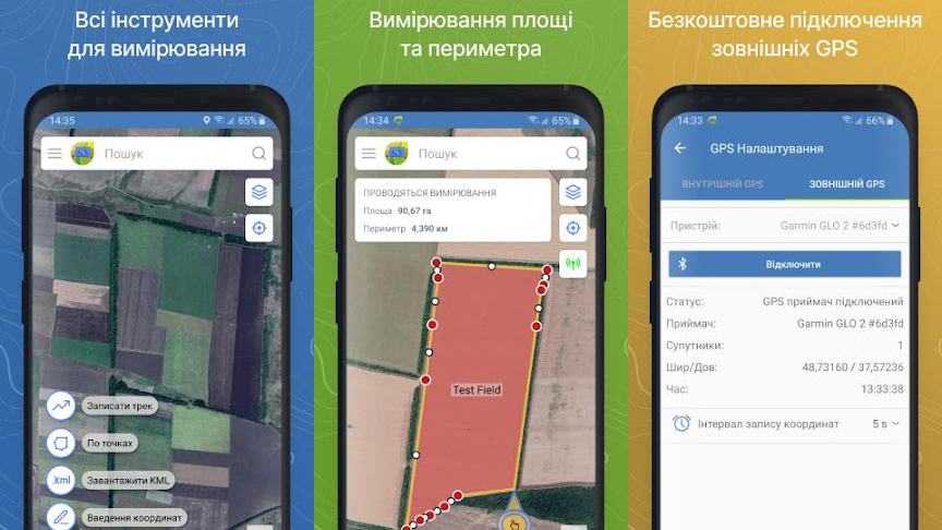
Typically, when digitizing a land bank and compiling electronic maps, different methods are used to measure the area of fields. The main ones include walking or driving around the field along its perimeter, using satellite data and flying drones over the field. Each technology has its own advantages and disadvantages and is aimed at different consumers. The simplest and most accessible method of measuring the area of land is to use a mobile device on which the Soft.Farm application «GPS. Fields. Area Measure» is installed. It can be used to create fields and measure their area in different ways. For example, you can mark control points on the map and save the resulting field contour without leaving the office, or you can download ready-made files in kml, shp, plt formats or enter the existing geographic coordinates of control points manually. To measure the field area on the ground, there is a track recording function. With its help, you can follow the perimeter of the land plot, using a smartphone or tablet as a GPS receiver, and then save the track in kml format for further file export. For more accurate measurements, it is possible to connect external antennas via Bluetooth and, thanks to them, receive GNSS or RTK signals. Thus, when compiling electronic field maps, each agricultural enterprise independently chooses the optimal method for measuring the cultivated area, focusing on its needs and available tools.
An electronic field map is a convenient and effective tool in the farm management system. The activities of any agricultural enterprise are based on it, so the Soft.Farm team has expanded and improved the «Field Map» module to make working with it even easier and more convenient. There are times when users do not have time to read instructions, and in the first stages of working with a web service it is difficult to figure out where to start. The updated functionality is aimed at helping the user with the first login to the program and teaching him how to work in it. A set of tips and an intuitive interface make it possible to build an algorithm of actions and navigate the next steps.
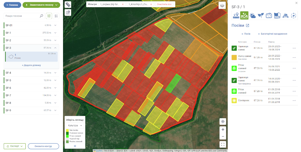
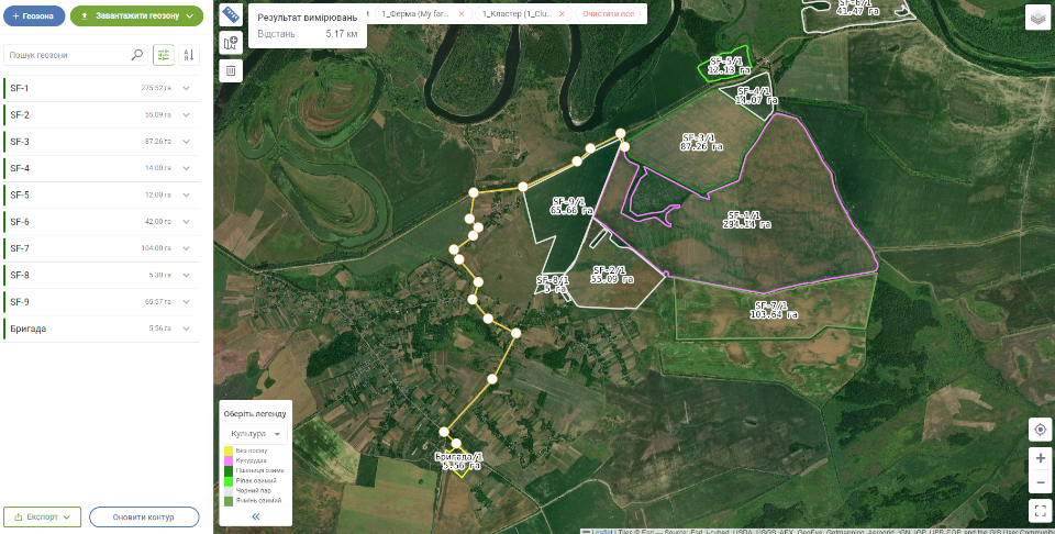
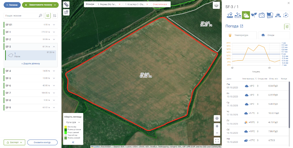
Using the «Field Map» module, you can see the structure of your fields, their area, location, measure the distance between fields or the most important farm objects, such as a grain store or an elevator, and thereby optimize the consumption of fuels and lubricants, as well as set up logistics. For convenient visualization of fields on the map, a legend has been added for displaying them by land type and crop.
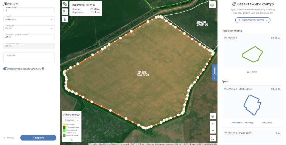
Field contours can be loaded from ready-made files in different formats, such as kml, shp, geojson, wkt, gpx, topojson, plt. If centimeter precision is not needed, it is possible to apply the contours manually. If you have a large land bank, you can use the search or filter functions to further work with the needed field or to edit it.

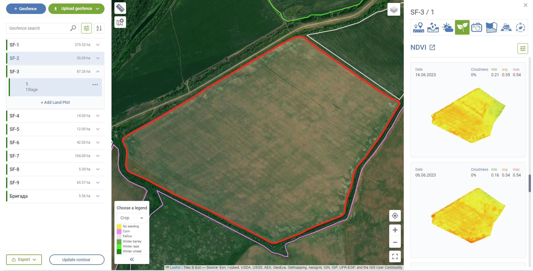
Each field contains all the necessary information, such as enterprise, department, type of land, crop rotation schemes, area according to documents, etc., and all information about acts in the field is posted on a detailed page. Using the functional buttons, you can analyze the results of past seasons, make strategic and operational decisions in the current period and make plans for the future. It is now possible to see and create crops immediately on a detailed page, view a weather log, NDVI images for any period, field surveys using agroscouting, cartograms, VRA task maps or documents for selected fields in one module, which greatly simplifies navigation through the web service.
Today, electronic field maps are a necessary element for the implementation of precision farming, crop yield forecasting, budget optimization and settlement of territorial disputes. Thanks to their use, a farm with any land bank can increase its efficiency.
Back to news list