Digital Agro Scouting: How to Turn Data into Yields and Profits
12.05 2026
Modern agriculture is about managing risks in the face of climate instability, pest threats, and ever-increasing production costs. In such circumstances, digital agro scouting becomes not just a control tool, but an early warning and productivity management system.
What is digital agro-scouting and why is it useful for a farmer?
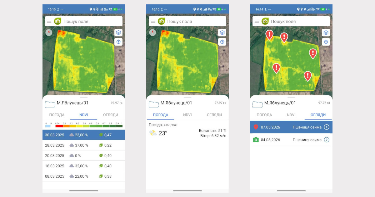
Digital agro-scouting from Soft.Farm is a systematic monitoring of crop conditions using specially developed software, mobile applications, satellite images, vegetation indices, recording of local inspections and analytics in a single platform.
Its key tasks are:
- search for problem areas with exact coordinates;
- documenting crop conditions (photos, comments, threat detection, change history);
- vegetation analysis using satellite images;
- monitoring the work of agronomists
and, as a result, minimizing financial losses.
In practice, it means that the farmer or farm manager sees not the “big picture”, but specific problem areas, the dynamics of the plant life cycle and the specialist responsible for the inspection.
Agroscouting + NDVI: how to combine satellite data and field inspection
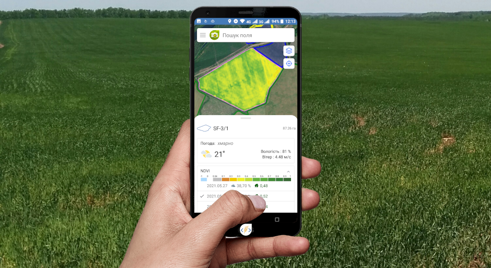
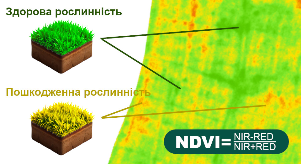
One of the most powerful tools of digital agroscouting is NDVI (Normalized Difference Vegetation Index) — an index that shows the intensity of photosynthesis and the state of biomass.
The combination of satellite analytics and physical field inspection is the foundation of modern digital crop management. Separately, NDVI provides only a variability map, and physical field inspection on the ground — only a local vision of the situation. Together, they form a system of early diagnosis and precise intervention.
The algorithm of work is as follows:
- obtaining a satellite image and analyzing it;
- field zoning and identifying areas with deviations in the NDVI index;
- forming a task for the agronomist to check a specific geozone (a point task is created with GPS coordinates of the area that needs attention);
- conducting an inspection, photofixing and diagnosing the problem, entering the relevant data into the system;
- decision-making (local fertilization, application of crop protection products, reseeding, etc.).
The maximum effect is achieved when conducting NDVI analysis in combination with other data layers:
- yield maps of previous years;
- fertilizer application data;
- crop protection treatment history;
- agrochemical soil parameters;
- topography.
Then agroscouting moves from the level of “response” to the level of analytical management of field productivity. A single snapshot gives a static picture. But the real value is provided by a series of snapshots throughout the growing season, which are stored in the field history in the Soft.Farm system. Thus, NDVI becomes a tool for point management, and not just a visualization of the field.
How to detect stress, diseases and pests at an early stage using NDVI
Early detection is the key to savings and high yields.
NDVI helps to see:
- deficiencies of chemical elements;
- stress from moisture deficiency;
- root system damaging;
- initial stages of fungal diseases;
- pest populations.
Important: the index records a decrease in photosynthetic activity even before the problem becomes visually obvious.
For example, a local drop in NDVI within one zone may indicate the onset of an infection or a nutritional deficiency. If you intervene at this point, treatment costs will be minimal, and the yield will be preserved. A problem detected in time saves the crop and insures against financial risks.
Field visit control and task formation for agronomists
In the traditional approach, control of the agronomist's work is often based on verbal reports. Digital agroscouting changes this.
The system allows you to:
- plot a route using GPS;
- record the date and time of the inspection;
- analyze the number and results of visits to each field;
- create regular or emergency tasks.
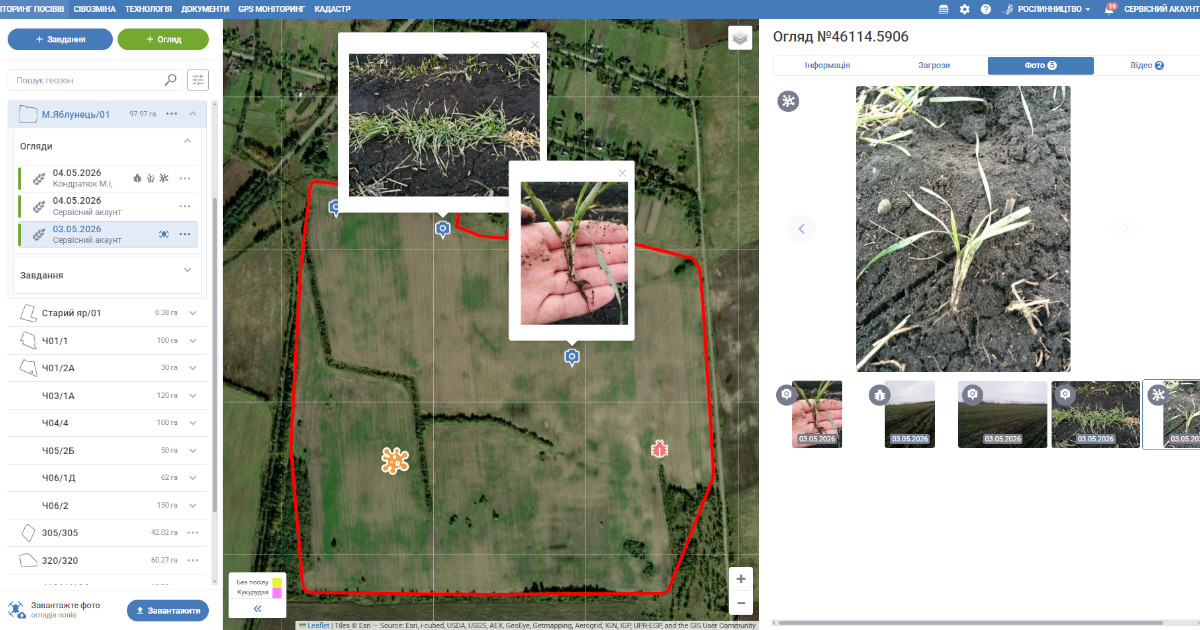
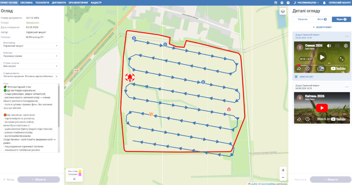
An agroscout or agronomist collects data in the field using a tablet with the Agroscouting mobile application, which allows you to quickly find fields using built-in satellite navigation and automatically records the dates and times of their visits, which makes it possible to control the quality of the inspection.
He draws up a georeferenced Inspection Report for the inspected areas, adds photos and text notes. The application has a built-in database of diseases, pests and weeds, which simplifies adding them to the report if they are detected during the inspection.
The manager sees:
- which fields have been inspected;
- which areas have not been inspected;
- how quickly they responded to the problem.
This increases discipline, reduces the human factor and creates a transparent system of responsibility.
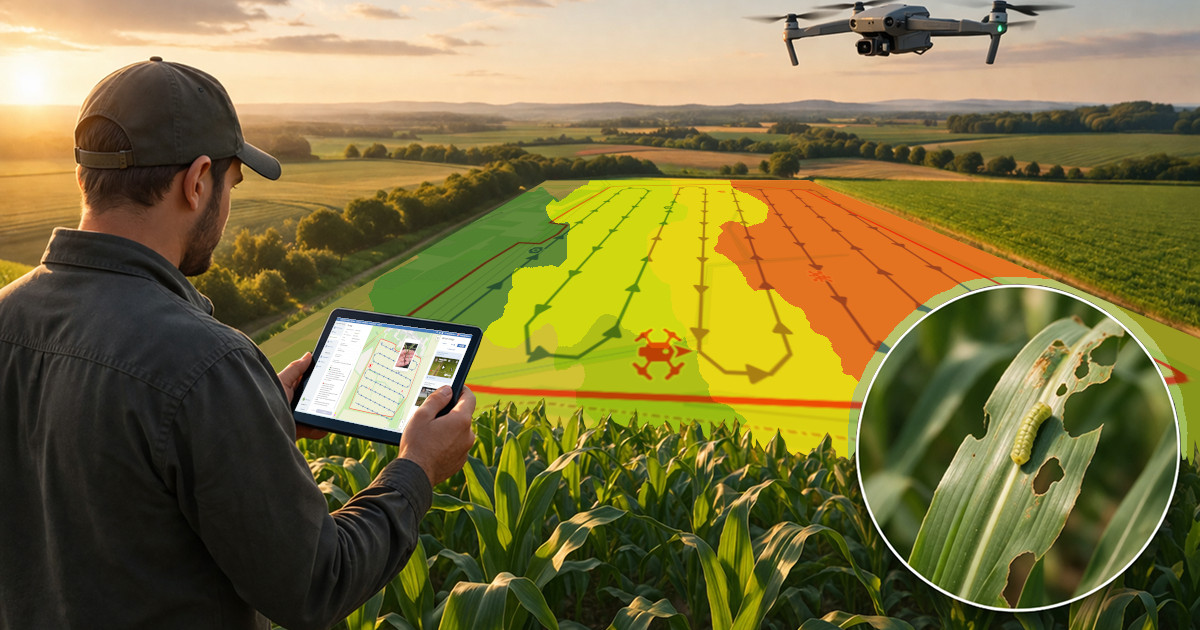
Agroscouting and drone inspections
Modern drones are a convenient tool for inspecting the condition of crops from a bird's eye view. Data obtained from a UAV can be included in the inspection in the web version of the Agroscouting module. It is possible to add files in the ".SRT" format and while watching the video, not only observe on the map where the drone is located, but also see its track.
The drone provides detailing of problem areas that were detected by the satellite. This is especially important for:
- uneven plant growth;
- flooding;
- local damage;
- assessing the extent of damage.
The combination of a satellite, a drone and a field inspection creates a three-level control system.
Economic effect of implementing digital agro-scouting
Practice shows that using the agro-scouting system allows farms to obtain:
- reduction in crop protection costs;
- more stable yields;
- faster response to risks;
- control of technological operations;
- a transparent agricultural production management system.
In modern agribusiness, the successful one is not the one who processes more, but the one who makes accurate decisions faster. As a result, a problem detected in time preserves the harvest, reduces costs, and insures the farm against financial risks.
That is why digital agro-scouting today is not an additional service, but a basic element of effective agricultural production.
Back to news list